Prescription: Nature…
(a 2020 update original post May 2015)
In this time of isolation from ‘the world’, it seems ‘nature’ has never been more potent. If you’re are lucky enough to be able to get out and about, I sincerely hope you are able to find space to enjoy some ‘nature’.
Em & I have always enjoyed getting out and walking, but it’s easy to say we won’t bother and find another distraction like homework, jobs round the house, or that episode of whatever that we need to catch up on. Yes, the kids groan at the prospect, but once out they really enjoy it.
Thanks to great websites and guides like Leicestershire’s choosehowyoumove.co.uk it’s easy to find a good easy round walks near you. Check out their Local Walking Guides. We also recommend the View Ranger mobile app, there are loads of free walks on it, judt type in a postcode – and in my experience, I have found it’s better at tracking and mapping than Strava.
Below are seven easy round walks in North and East Leicestershire
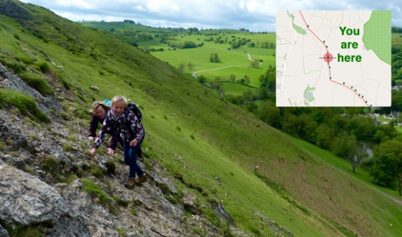
Walk One: Burrough – Somerby Round – 5.6miles.
Added June 2020 (During Social Isolation period)
We’ve walked from Burrough Hill to Somerby a few times, but we’ve never made it past the award-winning Ales in Somerby. With pubs closed we ventured back and found a great circular route!


Walk Two: our Barrow-Mountsorrel-Quorn Round – 8miles.
Added May 2020 (During Social Isolation period)
We gradually extended this walk to about 8.5 miles, after doing the Barrow to Mountsorrel a few times.
It’s a great walk to do and take a picnic for half-way!


Walk three: our Syston-Goscote Round – 5miles.
Added May 2020 (During Social Isolation period)
Another favourite of ours, about 5 miles from Syston around Beedles Lake and Gosocote and back.


Walk four: Wing in Rutland.
(May 2015) This is an easy almost 6 mile walk from the beautiful Wing, to the shores of Rutland Water at and back to Wing and the welcome King’s Arms for a wet and some pork crack.
See the leaflet Discover Rutland’s Wing Walks Leaflet


Walk five: Rearsby to Brooksby.
(May 2015) A delightful 4.25 mile walk from Rearsby through the fields and the Wreak Valley.
Two pubs to choose from at the end – do both!
See the leaflet Leicestershire Council Parish Walks Leaflet Rearsby


Walk six: Harby in the Vale of Belvoir.
(May 2015) A simple 6 miles from Harby climbing a tad to see views of the Vale of Belvoir.
Nag’s Head say no more.
See the leaflet Leicestershire Council Parish Walks Leaflet Harby


Walk seven: Harby to Hose, and back.
Added May 2020 (During Social Isolation period)
(Walk 3 of the 4 on the Leaflet Leicestershire Council Parish Walks Leaflet Harby
A simple 3.5 miles from Harby to Hose and back along the Canal (Vale of Belvoir).
As you may have noticed, we now use View Ranger – much better at tracking and mapping than Strava.


 So we needed to get out and what better way than to look for an easy round walk in the country.